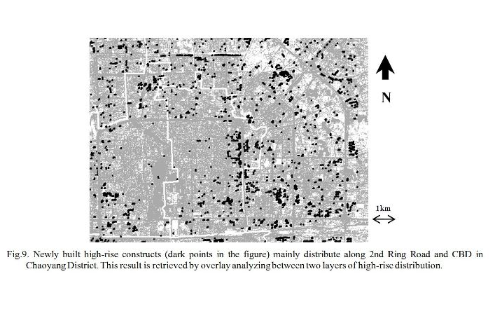
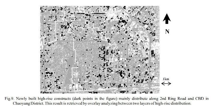
Ye, Z., Deng C., & Gong H. "Acquiring height distribution information about high-rises in Beijing using shadow in SPOT-5", Geoinformatics 2008 and Joint conference on GIS and Built Environment, Proc. SPIE. Vol.7147:71470S, Nov.7, 2008.
Ye, Z., Zhu L., & Gong. H. "Extracting height distribution information about high-rise buildings of Beijng using shadow in SPOT-5 data", IGARSS 2008 (Accepted for Oral Presentation).
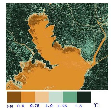
Ye, Z., Qin Z., & Gong H. Land surface temperature retrieval and spatial variation analysis using Landsat TM6 in Hongze Lake, Journal of Capital Normal University (Natural Science), Vol.30(1):112-119, Feb, 2009.
Queally, N., Ye, Z., Zheng, T., Chlus, A., Schneider, F., Pavlick, R. P., & Townsend, P. A. (2022). FlexBRDF: A flexible BRDF correction for grouped processing of airborne imaging spectroscopy flightlines. Journal of Geophysical Research: Biogeosciences, 127(1), e2021JG006622. https://doi.org/10.1029/2021JG006622
Kang, Y., Özdoğan, M., Zhu, X., Ye, Z., Hain, C., & Anderson, M. (2020). Comparative assessment of environmental variables and machine learning algorithms for maize yield prediction in the US Midwest. Environmental Research Letters, 15(6), 064005. https://doi.org/10.1088/1748-9326/ab7df9
Wang, Z., Chlus, A., Geygan, R., Ye, Z., Zheng, T., Singh, A., Couture, J.J., Cavender‐Bares, J., Kruger, E.L. and Townsend, P.A. (2020). Foliar functional traits from imaging spectroscopy across biomes in eastern North America. New Phytologist, 228(2), 494-511. https://doi.org/10.1111/nph.16711
Chang, C., Ye, Z., Huang, Q., & Wang, C. (2015, November). An integrative method for mapping urban land use change using "geo-sensor" data. In Proceedings of the 1st International ACM SIGSPATIAL Workshop on Smart Cities and Urban Analytics (pp. 47-54). https://doi.org/10.1145/2835022.2835031
Zheng, T., Ye, Z., Singh, A., Desai, A. R., Krishnayya, N. S. R., Dave, M. G., & Townsend, P. A. (2024). Variability in forest plant traits along the Western Ghats of India and their environmental drivers at different resolutions. Journal of Geophysical Research: Biogeosciences, 129(3), e2023JG007753. https://doi.org/10.1029/2023JG007753
Lien, M. R., Barker, R. J., Ye, Z., Westphall, M. H., Gao, R., Singh, A., ... & Townsend, P. A. (2019). A low-cost and open-source platform for automated imaging. Plant Methods, 15, 1-14. https://doi.org/10.1186/s13007-019-0392-1
Poster Presentation
Zhiwei Ye and Annemarie Schneider. "Automated characterization od urban expansion in complex landscapes in China using dense temporal stacks of Landsat data", ASPRS 2011 Annual Conference, Milwaukee, WI, USA, May, 2011.
Zhiwei Ye, Ting Zheng, Daniel Sousa, and Philip A Townsend. "A universal method for estimating vegetation fractional cover in forested areas using hyperspectral imagery", AGU22, Chicago, IL, USA, Dec, 2022.
Zhiwei Ye Ting Zheng, and Philip A. Townsend. "Adaptive endmember extraction in hyperspectral fractional cover mapping", AGU25, New Orleans, LA, USA, Dec, 2025.